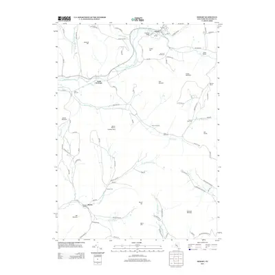
2013 Map of Hobart
USGS Topo · Published 2013About this map
Hobart sits along the northern reaches of the West Br Delaware River, serving as a central hub in this corner of Delaware County. The landscape is defined by the deep valleys and high summits of the Catskill Mountains, including Plattekill Mountain and Lyon Mountain. Settlement patterns follow the winding watercourses, with the village of South Kortright positioned downstream and Bovina tucked into the Crescent Hollow area to the southwest.
Find a feature on this map
93 named features on this map. Tap any name to fly to it.
Don’t see what you’re looking for? This feature index may not catch every label — zoom into the map to look around manually.
Map Details
Editions of this 2013 Hobart Map
This is the sole edition of this map. No revisions or reprints were ever made.
Other maps of this area

1901 · Margaretville
USGS Topo · 1:62,500

1904 · Hobart
USGS Topo · 1:62,500

1904 · Margaretville
USGS Topo · 1:62,500

1909 · Delhi
USGS Topo · 1:62,500

1911 · Delhi
USGS Topo · 1:62,500

1922 · Andes
USGS Topo · 1:62,500

1924 · Andes
USGS Topo · 1:62,500

1943 · Bloomville
USGS Topo · 1:24,000
1943 · Davenport
USGS Topo · 1:24,000
1945 · Davenport
USGS Topo · 1:31,680