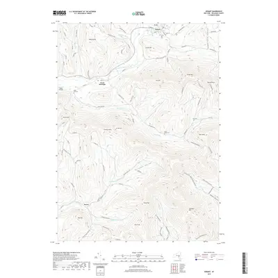
2019 Map of Hobart
USGS Topo · Published 2019About this map
The West Branch Delaware River winds through this Delaware County landscape, connecting the village of Hobart with the settlement of South Kortright. This region is defined by its deep hollows and prominent peaks, such as Lyon Mtn and Plattekill Mtn, which frame the valley corridors. Local genealogy is well-represented through several historic burial sites, including Locust Hill Cem near Hobart and Valley View Cem further south. The map documents a network of rural routes like Stamford River Rd and Roses Brook Rd that follow the natural contours of the land. Waterways such as Rose Brook and the Little Delaware River emphasize the importance of these drainage basins to the area's development. Smaller landmarks like Grace's Landing and the remote Relay Cem offer specific points of interest for researchers studying the historical footprint of this Catskill Mountain region.
Find a feature on this map
100 named features on this map. Tap any name to fly to it.
Don’t see what you’re looking for? This feature index may not catch every label — zoom into the map to look around manually.
Map Details
Editions of this 2019 Hobart Map
This is the sole edition of this map. No revisions or reprints were ever made.
Other maps of this area

1901 · Margaretville
USGS Topo · 1:62,500

1904 · Hobart
USGS Topo · 1:62,500

1904 · Margaretville
USGS Topo · 1:62,500

1909 · Delhi
USGS Topo · 1:62,500

1911 · Delhi
USGS Topo · 1:62,500

1922 · Andes
USGS Topo · 1:62,500

1924 · Andes
USGS Topo · 1:62,500

1943 · Bloomville
USGS Topo · 1:24,000
1943 · Davenport
USGS Topo · 1:24,000
1945 · Davenport
USGS Topo · 1:31,680