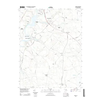
2014 Map of Hobbs
USGS Topo · Published 2014About this map
Denton serves as the focal point for this survey of eastern Maryland, where the Choptank River winds past historic riverfront sites like Pealiquor Landing and Lyford Landing. The landscape is defined by its intricate drainage network, including Watts Creek, Herring Run, and Fowling Cr, which feed into local landmarks such as Williston Lake and Smithville Community Lake.
Find a feature on this map
106 named features on this map. Tap any name to fly to it.
Don’t see what you’re looking for? This feature index may not catch every label — zoom into the map to look around manually.
Map Details
Editions of this 2014 Hobbs Map
This is the sole edition of this map. No revisions or reprints were ever made.
Other maps of this area

1905 · Denton
USGS Topo · 1:62,500

1905 · Hurlock
USGS Topo · 1:62,500

1915 · Seaford
USGS Topo · 1:62,500

1918 · Harrington
USGS Topo · 1:62,500

1944 · Denton
USGS Topo · 1:31,680
1944 · Preston
USGS Topo · 1:31,680

1944 · Federalsburg
USGS Topo · 1:31,680
1944 · Ridgely
USGS Topo · 1:31,680

1944 · Seaford
USGS Topo · 1:62,500

1944 · Hobbs
USGS Topo · 1:31,680