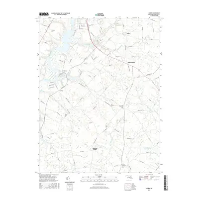
2017 Map of Hobbs
USGS Topo · Published 2017About this map
The Choptank River winds through the western edge of this Caroline County landscape, defining the peninsula of Tuckahoe Neck and feeding into Williston Lake. The area is characterized by a dense network of rural roads connecting small residential hubs and agricultural tracts, with the southern portion of Denton appearing in the northwest. Local geography is shaped by numerous minor tributaries such as Watts Creek, Herring Run, and Wolfpit Br, which drain the low-lying terrain. Several community focal points are documented, including the crossroads at American Corner, the settlement of Andersontown, and the small community of Bureau. For those researching family history, the map precisely locates several burial sites, such as Ames Cem, Concord Cem, and Todds Chapel Cem, alongside landmarks like Opossum Hill and the recreational waters of Smithville Community Lake.
Find a feature on this map
109 named features on this map. Tap any name to fly to it.
Don’t see what you’re looking for? This feature index may not catch every label — zoom into the map to look around manually.
Map Details
Editions of this 2017 Hobbs Map
This is the sole edition of this map. No revisions or reprints were ever made.
Other maps of this area

1905 · Denton
USGS Topo · 1:62,500

1905 · Hurlock
USGS Topo · 1:62,500

1915 · Seaford
USGS Topo · 1:62,500

1918 · Harrington
USGS Topo · 1:62,500

1944 · Denton
USGS Topo · 1:31,680
1944 · Preston
USGS Topo · 1:31,680

1944 · Federalsburg
USGS Topo · 1:31,680
1944 · Ridgely
USGS Topo · 1:31,680

1944 · Seaford
USGS Topo · 1:62,500

1944 · Hobbs
USGS Topo · 1:31,680