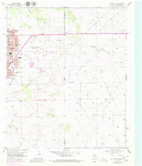
1969 Map of Hobbs East
USGS Topo · Published 1980About this map
The eastern edges of Hobbs meet the vast East Hobbs Oil Field in this late-1960s survey, updated with late-1970s revisions. The urban core shows a dense concentration of civic and educational infrastructure, including Highland Jr High Sch, Taylor Sch, and Washington Sch, alongside community hubs like Eagle Stadium and Maryland Park. The landscape is bisected by the New Mexico Texas state line and the Lea Co Gaines Co boundary, where the terrain is marked by the natural depression of Seminole Draw. A massive network of pipelines and pumping infrastructure, including a prominent Pumping Sta, underscores the region's reliance on petroleum extraction. On the southern outskirts, Prairie Haven Cem and Everglades Cem offer significant points of interest for genealogists tracing local families in this industrial borderland.
Find a feature on this map
27 named features on this map. Tap any name to fly to it.
Don’t see what you’re looking for? This feature index may not catch every label — zoom into the map to look around manually.
Map Details
Editions of this 1969 Hobbs East Map
Other maps of this area

1954 · Hobbs
USGS Topo · 1:250,000

1958 · Hobbs
USGS Topo · 1:250,000

1969 · Humble City
USGS Topo · 1:24,000

1969 · Hobbs SW
USGS Topo · 1:24,000

1969 · Hobbs East
USGS Topo · 1:24,000

1969 · Hobbs SE
USGS Topo · 1:24,000

1969 · Hobbs West
USGS Topo · 1:24,000

1969 · Humble City SE
USGS Topo · 1:24,000

1970 · Humble City SE
USGS Topo · 1:24,000

1971 · Brinson Ranch
USGS Topo · 1:24,000