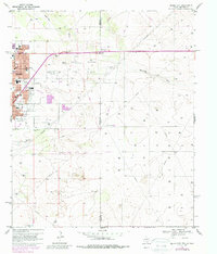
1969 Map of Hobbs East
USGS Topo · Published 1987About this map
The East Hobbs Oil Field dominates this West Texas and New Mexico borderlands landscape, where a dense network of pipelines and wells spreads east from the city of Hobbs. The map illustrates the town's expansion toward the State Line, showing a structured urban grid with essential community landmarks like the Taylor Memorial Hospital, Eagle Stadium, and the Armory. Education and religion are deeply rooted in the local geography, evidenced by sites such as Coronado School, Taylor School, and the Jefferson St Church.
Find a feature on this map
31 named features on this map. Tap any name to fly to it.
Don’t see what you’re looking for? This feature index may not catch every label — zoom into the map to look around manually.
Map Details
Editions of this 1969 Hobbs East Map
Other maps of this area

1954 · Hobbs
USGS Topo · 1:250,000

1958 · Hobbs
USGS Topo · 1:250,000

1969 · Humble City
USGS Topo · 1:24,000

1969 · Hobbs SW
USGS Topo · 1:24,000

1969 · Hobbs East
USGS Topo · 1:24,000

1969 · Hobbs SE
USGS Topo · 1:24,000

1969 · Hobbs West
USGS Topo · 1:24,000

1969 · Humble City SE
USGS Topo · 1:24,000

1970 · Humble City SE
USGS Topo · 1:24,000

1971 · Brinson Ranch
USGS Topo · 1:24,000