
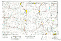
1954 Map of Hobbs
USGS Topo · Published 1963About this map
The High Plains and the Permian Basin converge in this mid-century survey, where the infrastructure of the burgeoning petroleum and potash industries is etched into the arid landscape. The Texas-New Mexico RR serves as a critical corridor through the region, connecting the major hubs of Hobbs, Andrews, and Lovington. Industrial development is prominently marked by the Sulphur and Potash Company and a large Potash Mine and Plant in the western reaches, indicating the intensive resource extraction that shaped local economies during this era.
Find a feature on this map
68 named features on this map. Tap any name to fly to it.
Don’t see what you’re looking for? This feature index may not catch every label — zoom into the map to look around manually.
Map Details
Editions of this 1954 Hobbs Map
2 editions found
Other maps of this area

1925 · Orla 2-b
USGS Topo · 1:48,000

1931 · Orla
USGS Topo · 1:62,500

1939 · Carlsbad
USGS Topo · 1:62,500

1939 · Nash Draw
USGS Topo · 1:62,500

1942 · Clayton Basin
USGS Topo · 1:62,500

1943 · Carlsbad
USGS Topo · 1:62,500

1943 · Clayton Basin
USGS Topo · 1:62,500

1943 · Oil City
USGS Topo · 1:62,500

1943 · Nash Draw
USGS Topo · 1:62,500

1945 · Malaga
USGS Topo · 1:62,500