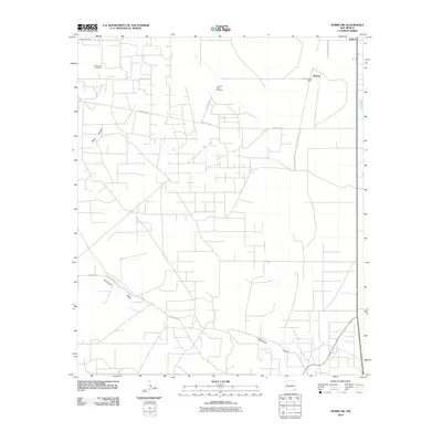
2010 Map of Hobbs SW
USGS Topo · Published 2010About this map
Monument Cemetery sits in the northwest corner of this West Texas borderlands landscape, a primary point of interest for genealogists tracing families in the Permian Basin. This high-plains terrain is defined by a dense grid of service roads and section lines, supporting a combination of ranching operations like the S and W Cattle Company and the energy infrastructure of Lea County. The settlement of Warren and its Warren Post Office provide a glimpse into the local rural centers that have historically served the surrounding cattle country. Cutting across the lower half of the quadrangle, the ephemeral course of Monument Draw passes near the White Breaks, illustrating the natural drainage patterns of this arid region. The map also captures the layout of Nadine and the primary thoroughfare of Monument Hwy, showing the intersection of local industry and transport at the start of the 21st century.
Find a feature on this map
13 named features on this map. Tap any name to fly to it.
Don’t see what you’re looking for? This feature index may not catch every label — zoom into the map to look around manually.
Map Details
Editions of this 2010 Hobbs SW Map
This is the sole edition of this map. No revisions or reprints were ever made.
Other maps of this area

1954 · Hobbs
USGS Topo · 1:250,000

1958 · Hobbs
USGS Topo · 1:250,000

1963 · Oil Center
USGS Topo · 1:62,500

1963 · Monument
USGS Topo · 1:62,500

1969 · Hobbs SW
USGS Topo · 1:24,000

1969 · Hobbs East
USGS Topo · 1:24,000

1969 · Eunice
USGS Topo · 1:24,000

1969 · Hobbs SE
USGS Topo · 1:24,000

1969 · Eunice NE
USGS Topo · 1:24,000

1969 · Hobbs West
USGS Topo · 1:24,000