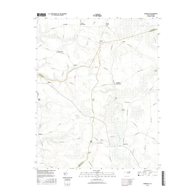
2016 Map of Hobbsville
USGS Topo · Published 2016About this map
The Perquimans River and its surrounding wetlands form the heart of this landscape along the border of Gates, Perquimans, and Chowan counties. The eastern edge of the quadrangle is defined by the massive reach of the Great Dismal Swamp, a terrain that has historically shaped the agricultural and settlement patterns of this coastal plain region. Numerous crossroads communities like Joppa, Hickory Crossroads, and Keys Crossroads are linked by a network of rural routes, including Sandy Cross Rd and Joppa Rd. For those researching local families, several established burial sites are documented, including Riddicks Grove Cem, Piney Woods Cem, and Chappells Hill Cem. The map reveals a transition from the swampy lowlands to more settled areas near Belvidere and Hobbsville, where the geography supports both small-scale farming and the preservation of long-standing community names like Sign Pine and Trotville.
Find a feature on this map
69 named features on this map. Tap any name to fly to it.
Don’t see what you’re looking for? This feature index may not catch every label — zoom into the map to look around manually.
Map Details
Editions of this 2016 Hobbsville Map
This is the sole edition of this map. No revisions or reprints were ever made.
Other maps of this area

1904 · Edenton
USGS Topo · 1:62,500

1906 · Hertford
USGS Topo · 1:62,500

1906 · Beckford
USGS Topo · 1:48,000

1907 · Beckford
USGS Topo · 1:62,500

1940 · Hertford
USGS Topo · 1:62,500

1940 · Beckford
USGS Topo · 1:62,500

1940 · South Mills
USGS Topo · 1:62,500

1942 · Edenton
USGS Topo · 1:62,500

1943 · Edenton
USGS Topo · 1:62,500

1952 · South Mills
USGS Topo · 1:62,500