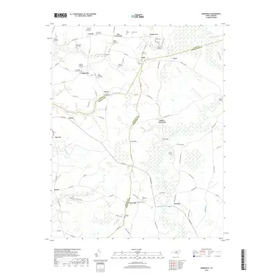
2019 Map of Hobbsville
USGS Topo · Published 2019About this map
The swampy lowlands of the Great Dismal Swamp reach into the northeastern corner of this coastal plain landscape, where the headwaters of the Perquimans River and Warwick Cr define the drainage of the Chowan and Gates county lines. Numerous small agricultural settlements such as Joppa, Trotville, and Hobbsville are connected by a network of rural roads that often follow the higher ground between creek beds. For genealogists, the map is remarkably dense with family burial sites, including the Genevieve Harrell Gravesite and the Josiah Overman Family Cem. Larger community landmarks like the Sandy Cross Baptist Church Cem and Hobbsville Baptist Church Cem serve as focal points for the surrounding farmsteads. The southern portion of the sheet near Belvidere and Snow Hill shows the characteristic interplay of timbered wetlands and cleared fields that has long sustained this part of North Carolina.
Find a feature on this map
91 named features on this map. Tap any name to fly to it.
Don’t see what you’re looking for? This feature index may not catch every label — zoom into the map to look around manually.
Map Details
Editions of this 2019 Hobbsville Map
This is the sole edition of this map. No revisions or reprints were ever made.
Other maps of this area

1904 · Edenton
USGS Topo · 1:62,500

1906 · Hertford
USGS Topo · 1:62,500

1906 · Beckford
USGS Topo · 1:48,000

1907 · Beckford
USGS Topo · 1:62,500

1940 · Hertford
USGS Topo · 1:62,500

1940 · Beckford
USGS Topo · 1:62,500

1940 · South Mills
USGS Topo · 1:62,500

1942 · Edenton
USGS Topo · 1:62,500

1943 · Edenton
USGS Topo · 1:62,500

1952 · South Mills
USGS Topo · 1:62,500