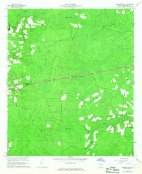
1966 Map of Hoboken East
USGS Topo · Published 1967About this map
Trail Ridge dominates the topography of this Brantley County landscape, creating a distinct elevated spine that separates the wetlands of the Georgia coastal plain. The Atlantic Coast Line railroad cuts a straight path through the center of the sheet, providing a vital transport corridor between the small settlements of Hoboken in the west and Hickox in the southeast. This period in the mid-1960s shows a region defined by its complex hydrologic system, where named wetlands like Kneekocker Swamp, Tiger Bay, and Raulerson Swamp dictate the patterns of human activity. The presence of a Lookout Tower and a Quarry near the rail lines suggests an economy tied to timber management and mineral extraction, while isolated landmarks like Buck Island appear as slightly higher ground within the surrounding Indian Swamp. The mapping of numerous branches such as Millpond Branch and Fort Camp Branch illustrates the intricate drainage network feeding into Buffalo Creek.
Find a feature on this map
16 named features on this map. Tap any name to fly to it.
Don’t see what you’re looking for? This feature index may not catch every label — zoom into the map to look around manually.
Map Details
Editions of this 1966 Hoboken East Map
2 editions found
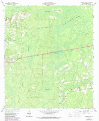
Other maps of this area

1917 · Nahunta
USGS Topo · 1:62,500

1918 · Hortense
USGS Topo · 1:62,500

1918 · Nahunta
USGS Topo · 1:62,500

1944 · Hortense
USGS Topo · 1:62,500

1946 · Brunswick
USGS Topo · 1:250,000

1948 · Brunswick
USGS Topo · 1:250,000

1953 · Waycross
USGS Topo · 1:250,000

1956 · Brunswick
USGS Topo · 1:250,000

1958 · Waycross
USGS Topo · 1:250,000

1961 · Brunswick
USGS Topo · 1:250,000