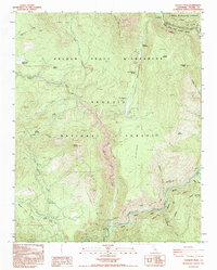
1993 Map of Hockett Peak
USGS Topo · Published 1995About this map
Hockett Peak and the surrounding high country of the Sequoia National Forest dominate this late-twentieth-century study of the southern Sierra Nevada. The landscape is defined by the steep drainage of the Little Kern River and the designated Kern Wild and Scenic River, which meet at the Forks of the Kern. Human presence is sparse, centered on seasonal outposts such as the Trout Meadows FS Station and Pyles Camp.
Find a feature on this map
43 named features on this map. Tap any name to fly to it.
Don’t see what you’re looking for? This feature index may not catch every label — zoom into the map to look around manually.
Map Details
Editions of this 1993 Hockett Peak Map
This is the sole edition of this map. No revisions or reprints were ever made.
Other maps of this area

1904 · Kaweah
USGS Topo · 1:125,000

1905 · Olancha
USGS Topo · 1:125,000

1907 · Olancha
USGS Topo · 1:125,000

1909 · Kaweah
USGS Topo · 1:125,000

1937 · Kaweah
USGS Topo · 1:125,000

1948 · Fresno
USGS Topo · 1:250,000

1955 · Fresno
USGS Topo · 1:250,000

1956 · Fresno
USGS Topo · 1:250,000

1956 · Hockett Peak
USGS Topo · 1:62,500

1956 · Mineral King
USGS Topo · 1:62,500