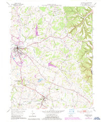
1953 Map of Hodgenville
USGS Topo · Published 1987About this map
The Abraham Lincoln Birthplace National Historic Site and the Abraham Lincoln Boyhood Home anchor this mid-century portrait of Larue County. Centered on the community of Hodgenville, the map reveals a landscape defined by the winding Nolin River and its numerous tributaries, including McDougal Creek and Knob Creek. This 1953 survey, later updated with photorevisions, illustrates the transition from traditional rural patterns to modern infrastructure.
Find a feature on this map
36 named features on this map. Tap any name to fly to it.
Don’t see what you’re looking for? This feature index may not catch every label — zoom into the map to look around manually.
Map Details
Editions of this 1953 Hodgenville Map
3 editions found
Other maps of this area

1934 · Munfordville
USGS Topo · 1:48,000

1935 · Elizabethtown
USGS Topo · 1:48,000

1937 · Munfordville
USGS Topo · 1:62,500

1938 · Elizabethtown
USGS Topo · 1:62,500

1949 · Tonieville
USGS Topo · 1:24,000

1949 · Elizabethtown
USGS Topo · 1:24,000
1949 · Elizabethtown
USGS Topo · 1:62,500

1953 · Howardstown
USGS Topo · 1:24,000

1953 · Nelsonville
USGS Topo · 1:24,000

1953 · Hibernia
USGS Topo · 1:24,000