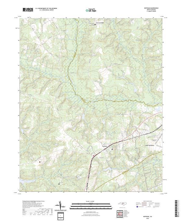
2022 Map of Hoffman
USGS Topo · Published 2022About this map
The town of Hoffman sits at the junction of several county lines in the North Carolina Sandhills, positioned where Richmond, Moore, and Scotland counties converge. This area is characterized by a high concentration of water features and military infrastructure, most notably the Mackall Army Airfield in the southeast. The landscape is dotted with several small lakes, including Crappie Lake, McKinney Lake, and Indian Camp Lake, which reflect the region's complex hydrology. Rural life is anchored by landmarks such as the Taylor Baptist Church and several family or community burial sites like Blue Cem and Watson Cem. The Seaboard St railroad line runs directly through the heart of the settlement, tracing the historical transportation corridor that once defined this portion of the interior state. This modern survey provides a detailed view of the local road network, from Main St to the winding tracks of Fire Tower Rd, while capturing the distinct elevation of Narrow Ridge to the north.
Find a feature on this map
65 named features on this map. Tap any name to fly to it.
Don’t see what you’re looking for? This feature index may not catch every label — zoom into the map to look around manually.
Map Details
Editions of this 2022 Hoffman Map
This is the sole edition of this map. No revisions or reprints were ever made.
Other maps of this area

1942 · Troy
USGS Topo · 1:125,000

1942 · Rockingham
USGS Topo · 1:125,000

1948 · Southern Pines
USGS Topo · 1:62,500

1948 · Pinebluff
USGS Topo · 1:24,000

1949 · Millstone Lake
USGS Topo · 1:24,000

1949 · Silver Hill
USGS Topo · 1:24,000

1949 · West End
USGS Topo · 1:24,000

1949 · Hoffman
USGS Topo · 1:24,000

1949 · Marston
USGS Topo · 1:24,000

1949 · Hamlet
USGS Topo · 1:24,000