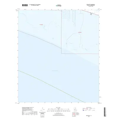
2018 Map of Hog Bayou
USGS Topo · Published 2018About this map
Grand Chenier Ridge stands as the primary topographical relief in this coastal landscape, situated along the northern edge of the Gulf of Mexico. This low-lying marsh environment is defined by an intricate network of waterways, including Hog Bayou, Beach Prong, and Pren Branch. The transition from open gulf waters to interior wetlands is marked by isolated water bodies like Crab Lake and Beach Pond, which are characteristic of the Louisiana chenier plain. Human modification of the drainage pattern is evident in features such as the Club Canal, which cuts through the wetlands south of the ridge. This area represents a critical intersection of marine and freshwater systems, where the natural hydrology of First Lake and the surrounding bayous meets the engineered corridors that navigate the parish's coastal marshes.
Find a feature on this map
12 named features on this map. Tap any name to fly to it.
Don’t see what you’re looking for? This feature index may not catch every label — zoom into the map to look around manually.
Map Details
Editions of this 2018 Hog Bayou Map
This is the sole edition of this map. No revisions or reprints were ever made.
Other maps of this area

1934 · Catfish Lake
USGS Topo · 1:24,000

1935 · Catfish Lake
USGS Topo · 1:31,680

1935 · Bay Labauve
USGS Topo · 1:31,680

1935 · Grand Chenier
USGS Topo · 1:31,680

1946 · Hog Bayou NE
USGS Topo · 1:31,680

1946 · Hog Bayou NW
USGS Topo · 1:31,680
1949 · Hog Bayou NW
USGS Topo · 1:31,680

1949 · Hog Bayou NE
USGS Topo · 1:31,680

1954 · Port Arthur
USGS Topo · 1:250,000
1955 · Sweet Lake
USGS Topo · 1:62,500