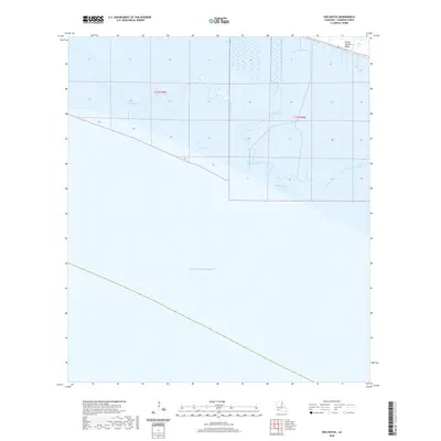
2020 Map of Hog Bayou
USGS Topo · Published 2020About this map
Grand Chenier Ridge stands as a distinct topographical feature along the coastline of Cameron Parish, where the land transitions into the vast expanse of the Gulf of Mexico. This coastal landscape is defined by an intricate network of waterways, including the winding course of Hog Bayou and the man-made Club Canal. The area’s geography is shaped by a series of brackish water bodies such as Crab Lake, Beach Pond, and First Lake, which are interconnected by smaller tributaries like Beach Prong and Pren Branch.
Find a feature on this map
12 named features on this map. Tap any name to fly to it.
Don’t see what you’re looking for? This feature index may not catch every label — zoom into the map to look around manually.
Map Details
Editions of this 2020 Hog Bayou Map
This is the sole edition of this map. No revisions or reprints were ever made.
Other maps of this area

1934 · Catfish Lake
USGS Topo · 1:24,000

1935 · Catfish Lake
USGS Topo · 1:31,680

1935 · Bay Labauve
USGS Topo · 1:31,680

1935 · Grand Chenier
USGS Topo · 1:31,680

1946 · Hog Bayou NE
USGS Topo · 1:31,680

1946 · Hog Bayou NW
USGS Topo · 1:31,680
1949 · Hog Bayou NW
USGS Topo · 1:31,680

1949 · Hog Bayou NE
USGS Topo · 1:31,680

1954 · Port Arthur
USGS Topo · 1:250,000
1955 · Sweet Lake
USGS Topo · 1:62,500