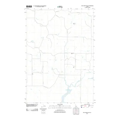
2010 Map of Hog Creek Butte
USGS Topo · Published 2010About this map
Hog Creek Butte serves as a central landmark for this portion of Washington County, overlooking a network of drainages and ranch roads at the turn of the 21st century. The landscape is defined by its water management systems, including Crane Creek Reservoir, Groner Reservoir, and several containment structures like Bruce Dam and Courtight Dam. These features illustrate the importance of irrigation and water storage for the high-desert agriculture typical of western Idaho.
Find a feature on this map
25 named features on this map. Tap any name to fly to it.
Don’t see what you’re looking for? This feature index may not catch every label — zoom into the map to look around manually.
Map Details
Editions of this 2010 Hog Creek Butte Map
This is the sole edition of this map. No revisions or reprints were ever made.
Other maps of this area

1894 · Squaw Creek
USGS Topo · 1:125,000

1897 · Weiser
USGS Topo · 1:125,000

1911 · Meadows
USGS Topo · 1:125,000

1954 · Council
USGS Topo · 1:62,500

1955 · Baker
USGS Topo · 1:250,000

1957 · Cambridge
USGS Topo · 1:62,500

1957 · Crane Creek Reservoir
USGS Topo · 1:62,500

1959 · Baker
USGS Topo · 1:250,000

1970 · Granger Butte
USGS Topo · 1:24,000
1970 · Riley Butte
USGS Topo · 1:24,000