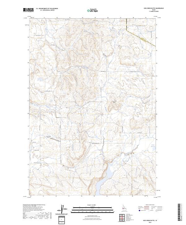
2024 Map of Hog Creek Butte
USGS Topo · Published 2024About this map
Hog Creek Butte rises as a prominent landmark in this corner of Idaho, where the boundary between Adams and Washington counties meets. The landscape is defined by a network of drainage systems including Dixie Creek, Hog Creek, and She Creek, which flow through undulating terrain characterized by features like Dutch Flat and Knob Hill. Human activity in this rural expanse is evidenced by the Coyote Ridge Airport and a grid of access routes such as Farm to Market Rd and Loney Rd. The presence of the Groner Reservoir and North Crane Creek in the southeast suggests a reliance on water management for the surrounding rangeland. This area maintains a low-density settlement pattern, with family names preserved in labels like Heinrich Rd, Curts Rd, and Louie Fave Rd.
Find a feature on this map
31 named features on this map. Tap any name to fly to it.
Don’t see what you’re looking for? This feature index may not catch every label — zoom into the map to look around manually.
Map Details
Editions of this 2024 Hog Creek Butte Map
This is the sole edition of this map. No revisions or reprints were ever made.
Other maps of this area

1894 · Squaw Creek
USGS Topo · 1:125,000

1897 · Weiser
USGS Topo · 1:125,000

1911 · Meadows
USGS Topo · 1:125,000

1954 · Council
USGS Topo · 1:62,500

1955 · Baker
USGS Topo · 1:250,000

1957 · Cambridge
USGS Topo · 1:62,500

1957 · Crane Creek Reservoir
USGS Topo · 1:62,500

1959 · Baker
USGS Topo · 1:250,000

1970 · Granger Butte
USGS Topo · 1:24,000
1970 · Riley Butte
USGS Topo · 1:24,000