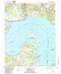
1984 Map of Hog Island
USGS Topo · Published 1984About this map
Hog Island and its surrounding wetlands dominate this stretch of the James River during the mid-1980s, illustrating a landscape where colonial history and modern infrastructure coexist. On the northern bank, the transition from historical preservation to contemporary recreation is evident in the proximity of the Kingsmill Plantation Site and Carters Grove Historical Home to the expansive grounds of Busch Gardens. The development of Kingsmill On The James reflects the era's residential growth near the Colonial National Historical Park. Across the water, the Gravel Neck peninsula is defined by the industrial presence of the Surry Nuclear Powerplant, a stark contrast to the preserved marshes of the Hog Island State Wildlife Management Area. Genealogists and local historians can trace legacy sites like the Travis Cem on Jamestown Island or the Little Zion Ch near Grove, alongside established transport links such as the Colonial Parkway and the Williamsburg Jamestown Airport.
Find a feature on this map
65 named features on this map. Tap any name to fly to it.
Don’t see what you’re looking for? This feature index may not catch every label — zoom into the map to look around manually.
Map Details
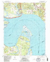
Editions of this 1984 Hog Island Map
2 editions found
Other maps of this area

1906 · Williamsburg
USGS Topo · 1:62,500

1907 · Yorktown
USGS Topo · 1:62,500

1917 · Toano
USGS Topo · 1:62,500

1918 · Toano
USGS Topo · 1:62,500

1919 · Surry
USGS Topo · 1:62,500

1943 · Yorktown
USGS Topo · 1:62,500

1943 · Richmond
USGS Topo · 1:250,000

1944 · Yorktown
USGS Topo · 1:24,000
1948 · Bacons Castle
USGS Topo · 1:24,000

1949 · Richmond
USGS Topo · 1:250,000