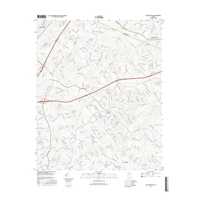
2017 Map of Hog Mountain
USGS Topo · Published 2017About this map
Hog Mountain serves as a central landmark in this 2017 survey of the Gwinnett County uplands, where the headwaters of several major river systems originate. The terrain is defined by the divides between the Apalachee River, Alcovy River, and Yellow River, illustrating the complex hydrology of this Georgia Piedmont region. While modern infrastructure like I-85 and sprawling residential corridors connect Buford in the northwest to Dacula in the south, the map preserves the names of older rural landmarks. Genealogists may find value in the locations of historic burial grounds such as Waters Cem, Fraiser Cem, and McElroy Cem. The landscape is further punctuated by numerous small water bodies, including Suwanee Creek Lake, Crowe Lake, and Partial Lake, reflecting a mixture of natural drainages and modern impoundments.
Find a feature on this map
25 named features on this map. Tap any name to fly to it.
Don’t see what you’re looking for? This feature index may not catch every label — zoom into the map to look around manually.
Map Details
Editions of this 2017 Hog Mountain Map
This is the sole edition of this map. No revisions or reprints were ever made.
Other maps of this area

1888 · Atlanta
USGS Topo · 1:125,000

1890 · Suwanee
USGS Topo · 1:125,000

1890 · Atlanta
USGS Topo · 1:125,000

1891 · Gainesville
USGS Topo · 1:125,000

1892 · Atlanta
USGS Topo · 1:125,000

1894 · Suwanee
USGS Topo · 1:125,000

1895 · Atlanta
USGS Topo · 1:125,000

1896 · Monroe
USGS Topo · 1:125,000

1953 · Atlanta
USGS Topo · 1:250,000

1953 · Athens
USGS Topo · 1:250,000