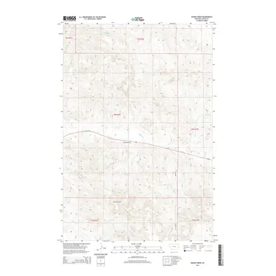
2014 Map of Hogan Creek
USGS Topo · Published 2014About this map
Locate Cr and its many tributaries carve a network of drainages across this Custer County landscape, where the high plains meet the intricate topography of southeastern Montana. This modern survey illustrates a territory primarily defined by its hydrology and the transit corridor of Us-12, which cuts east-to-west across the central terrain. The land is marked by deep geographic features like Johnnies Gulch, which runs parallel to the highway, and the Dead Cow Reservoir, a significant man-made water feature in this arid environment. To the south, Meyers Cr and Hogan Cr wind through the township divisions, while Knowlton Rd provides one of the few north-south overland routes through the breaks. The map captures a moment of modern land management within the Public Land Survey System, showing the precise township and range lines that govern these ranchlands.
Find a feature on this map
17 named features on this map. Tap any name to fly to it.
Don’t see what you’re looking for? This feature index may not catch every label — zoom into the map to look around manually.
Map Details
Editions of this 2014 Hogan Creek Map
This is the sole edition of this map. No revisions or reprints were ever made.
Other maps of this area

1953 · Miles City
USGS Topo · 1:250,000

1957 · Miles City
USGS Topo · 1:250,000

1958 · Miles City
USGS Topo · 1:250,000

1969 · Little Whitney Creek
USGS Topo · 1:24,000

1969 · Spring Draw
USGS Topo · 1:24,000

1969 · Knowlton
USGS Topo · 1:24,000

1969 · Hogan Creek
USGS Topo · 1:24,000

1969 · Locate SE
USGS Topo · 1:24,000

1969 · Montague Butte
USGS Topo · 1:24,000

1969 · Flat Top Butte SW
USGS Topo · 1:24,000