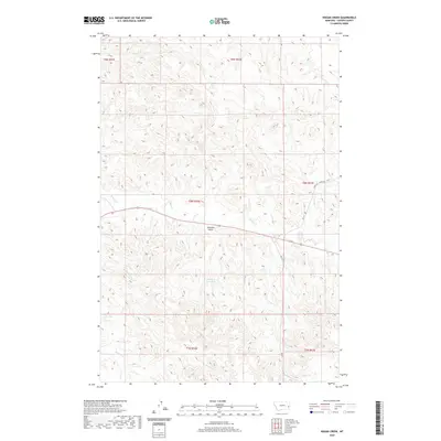
2020 Map of Hogan Creek
USGS Topo · Published 2020About this map
Locate Cr and Hogan Cr define the drainage patterns of this corner of Custer County, where the landscape is marked by a complex network of intermittent streams and coulees. The terrain is notably dissected by landforms such as Johnnies Gulch and the isolated Dead Cow Reservoir. Transportation through this cattle-country environment is facilitated by descriptive local routes, most notably the Terry Cut Across Rd, which provides a diagonal shortcut across the township lines. Other watercourses like Snow Cr, Rabbitfoot Cr, and Meyers Cr further illustrate the watershed's intricate design, which is essential for ranching operations in this semi-arid region. These features, along with secondary roads like Rd 417, reveal the practical infrastructure required to navigate and utilize these vast Montana rangelands.
Find a feature on this map
17 named features on this map. Tap any name to fly to it.
Don’t see what you’re looking for? This feature index may not catch every label — zoom into the map to look around manually.
Map Details
Editions of this 2020 Hogan Creek Map
This is the sole edition of this map. No revisions or reprints were ever made.
Other maps of this area

1953 · Miles City
USGS Topo · 1:250,000

1957 · Miles City
USGS Topo · 1:250,000

1958 · Miles City
USGS Topo · 1:250,000

1969 · Little Whitney Creek
USGS Topo · 1:24,000

1969 · Spring Draw
USGS Topo · 1:24,000

1969 · Knowlton
USGS Topo · 1:24,000

1969 · Hogan Creek
USGS Topo · 1:24,000

1969 · Locate SE
USGS Topo · 1:24,000

1969 · Montague Butte
USGS Topo · 1:24,000

1969 · Flat Top Butte SW
USGS Topo · 1:24,000