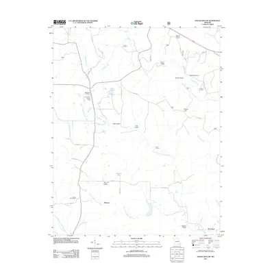
2011 Map of Hogan Hollow
USGS Topo · Published 2011About this map
Budapest and Beaverdam anchor the lower reaches of this Ozark plateau landscape, where the headwaters of the South Prong Beaverdam Creek and North Prong Beaverdam Creek converge. The topography is defined by a dense network of hollows, including Hogan Hollow, Pump Hollow, and Beehole Hollow, which drain the ridges toward Tenmile Creek. For local historians and genealogists, the map preserves the exact locations of family-associated sites such as the Margaret Trainor Cemetery, Kearbey Cemetery, and Collins Cemetery. Human impact on the land is reflected in aviation and forestry infrastructure, from the Mb Ranch Airport and the L W R Ranch Landing Strip to the Grandin Lookout Tower overlooking the drainage of the North Prong Little Black River. Modern water management is represented by Mallard Dam and Lake Hogan, situated along a complex system of county roads including Co RD 436 and Richmond RD.
Find a feature on this map
40 named features on this map. Tap any name to fly to it.
Don’t see what you’re looking for? This feature index may not catch every label — zoom into the map to look around manually.
Map Details
Editions of this 2011 Hogan Hollow Map
This is the sole edition of this map. No revisions or reprints were ever made.
Other maps of this area

1934 · Williamsville
USGS Topo · 1:48,000

1935 · Acorn
USGS Topo · 1:62,500

1939 · Doniphan
USGS Topo · 1:62,500

1940 · Williamsville
USGS Topo · 1:62,500

1940 · Naylor
USGS Topo · 1:62,500

1944 · Naylor
USGS Topo · 1:62,500

1944 · Grandin
USGS Topo · 1:62,500

1945 · Doniphan
USGS Topo · 1:62,500

1946 · Grandin
USGS Topo · 1:62,500

1957 · Poplar Bluff
USGS Topo · 1:250,000