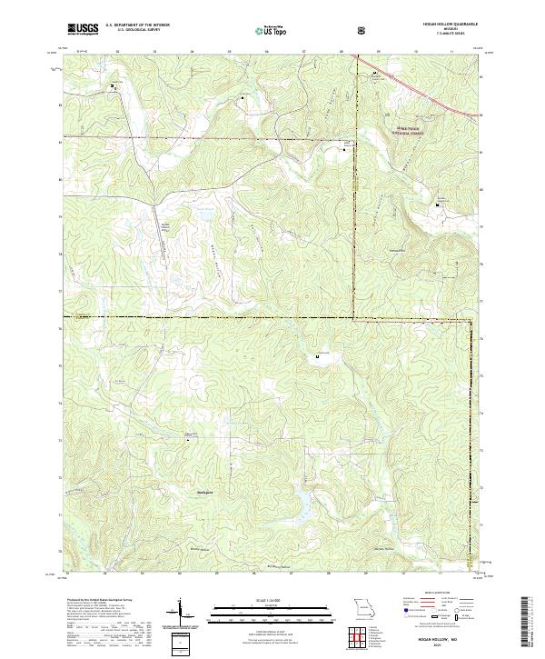
2021 Map of Hogan Hollow
USGS Topo · Published 2021About this map
Budapest and the surrounding timberlands define this section of the Ozark foothills, where the boundaries of Carter and Ripley counties meet within the Mark Twain National Forest. The landscape is etched by a complex network of drainage basins, notably Hogan Hollow, Puls Hollow, and Beehole Hollow. These narrow valleys historically dictated the placement of family burial grounds and small settlements away from the more frequent flooding of larger waterways like Tenmile Creek.
Find a feature on this map
48 named features on this map. Tap any name to fly to it.
Don’t see what you’re looking for? This feature index may not catch every label — zoom into the map to look around manually.
Map Details
Editions of this 2021 Hogan Hollow Map
This is the sole edition of this map. No revisions or reprints were ever made.
Other maps of this area

1934 · Williamsville
USGS Topo · 1:48,000

1935 · Acorn
USGS Topo · 1:62,500

1939 · Doniphan
USGS Topo · 1:62,500

1940 · Williamsville
USGS Topo · 1:62,500

1940 · Naylor
USGS Topo · 1:62,500

1944 · Naylor
USGS Topo · 1:62,500

1944 · Grandin
USGS Topo · 1:62,500

1945 · Doniphan
USGS Topo · 1:62,500

1946 · Grandin
USGS Topo · 1:62,500

1957 · Poplar Bluff
USGS Topo · 1:250,000