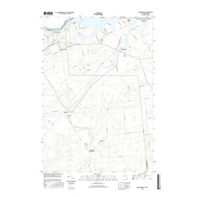
2016 Map of Hogansburg
USGS Topo · Published 2016About this map
Rooseveltown and Hogansburg stand at the intersection of international diplomacy and local geography along the Saint Lawrence Seaway. This northern New York borderlands area is defined by the convergence of the Raquette River, the Saint Regis River, and the Deer River. The presence of the Massena-Cornwall International Bridge and the Three Nations Crossing underscores the region's importance as a gateway between the United States and Canada.
Find a feature on this map
82 named features on this map. Tap any name to fly to it.
Don’t see what you’re looking for? This feature index may not catch every label — zoom into the map to look around manually.
Map Details
Editions of this 2016 Hogansburg Map
This is the sole edition of this map. No revisions or reprints were ever made.
Other maps of this area

1906 · Massena
USGS Topo · 1:62,500

1907 · Massena
USGS Topo · 1:62,500

1915 · Moira
USGS Topo · 1:62,500

1917 · Moira
USGS Topo · 1:62,500

1942 · Barnhart Island
USGS Topo · 1:24,000

1943 · Barnhart Island
USGS Topo · 1:31,680

1944 · Moira
USGS Topo · 1:62,500
1946 · Brasher Falls
USGS Topo · 1:24,000
1946 · Raquette River
USGS Topo · 1:24,000

1948 · Ogdensburg
USGS Topo · 1:250,000