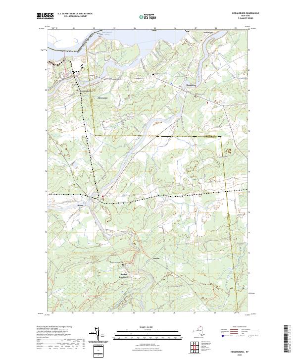
2023 Map of Hogansburg
USGS Topo · Published 2023About this map
The Saint Lawrence Seaway defines the northern boundary of this territory, where the international border meets the confluence of several major waterways. The Raquette River and the Saint Regis River flow through the northern settlements of Rooseveltown, Akwesasne, and Hogansburg, reflecting a landscape deeply connected to the riverine geography of the border region. Several community landmarks are preserved here, including the Mohawk Memorial Cem and Saint Joseph Cem, which speak to the area's cultural heritage.
Find a feature on this map
87 named features on this map. Tap any name to fly to it.
Don’t see what you’re looking for? This feature index may not catch every label — zoom into the map to look around manually.
Map Details
Editions of this 2023 Hogansburg Map
This is the sole edition of this map. No revisions or reprints were ever made.
Other maps of this area

1906 · Massena
USGS Topo · 1:62,500

1907 · Massena
USGS Topo · 1:62,500

1915 · Moira
USGS Topo · 1:62,500

1917 · Moira
USGS Topo · 1:62,500

1942 · Barnhart Island
USGS Topo · 1:24,000

1943 · Barnhart Island
USGS Topo · 1:31,680

1944 · Moira
USGS Topo · 1:62,500
1946 · Brasher Falls
USGS Topo · 1:24,000
1946 · Raquette River
USGS Topo · 1:24,000

1948 · Ogdensburg
USGS Topo · 1:250,000