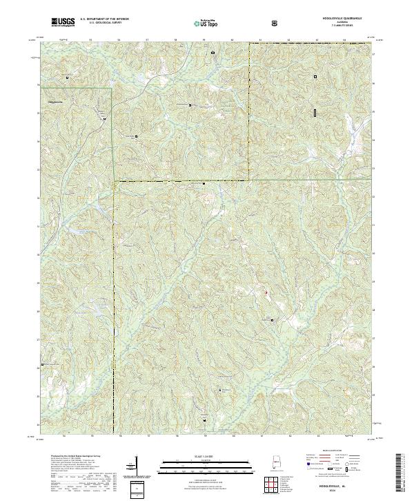
2024 Map of Hogglesville
USGS Topo · Published 2024About this map
Hogglesville serves as the focal point of this rural Alabama landscape, situated along the border of the Talladega National Forest. The map details a complex network of county roads and family-named routes, including Calhoun Rd, Walter Boyles Rd, and Jesse Townson Rd, which connect numerous community landmarks. The area is dense with historical sites for genealogical research, featuring several local burial grounds such as New Shiloh Cem, Old Shiloh Cem, and Providence Cem.
Find a feature on this map
61 named features on this map. Tap any name to fly to it.
Don’t see what you’re looking for? This feature index may not catch every label — zoom into the map to look around manually.
Map Details
Editions of this 2024 Hogglesville Map
This is the sole edition of this map. No revisions or reprints were ever made.
Other maps of this area

1953 · Montgomery
USGS Topo · 1:250,000

1956 · Montgomery
USGS Topo · 1:250,000

1957 · Montgomery
USGS Topo · 1:250,000

1979 · Marion North
USGS Topo · 1:24,000

1979 · Morgan Springs
USGS Topo · 1:24,000

1979 · Greensboro
USGS Topo · 1:24,000

1979 · Pondville
USGS Topo · 1:24,000

1980 · Payne Lake
USGS Topo · 1:24,000

1980 · Ingram
USGS Topo · 1:24,000
1980 · Hogglesville
USGS Topo · 1:24,000