
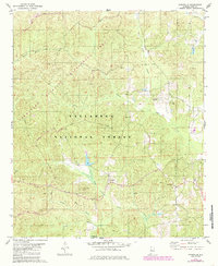
1979 Map of Pondville
USGS Topo · Published 1980About this map
Pondville serves as the central settlement in this late-1970s landscape, positioned near the intersection of Blue Girth Creek and Spring. The terrain is characterized by its network of watercourses, including Affonee Creek and Yeager Branch, which carve through the dense timberlands of the Talladega National Forest. For researchers, the map provides a look at rural community life through its numerous country churches and cemeteries, such as Friendship Ch and the Mathis Cem. An Old Railroad Grade and a Pipeline traverse the western and central portions of the quadrangle, indicating the shift from rail-based commerce to modern industrial infrastructure. This survey captures the region just as local industry, represented by scattered Gravel Pits, operated alongside traditional land use at the Bibb Co Perry Co boundary.
Find a feature on this map
24 named features on this map. Tap any name to fly to it.
Don’t see what you’re looking for? This feature index may not catch every label — zoom into the map to look around manually.
Map Details
Editions of this 1979 Pondville Map
2 editions found
Other maps of this area

1899 · Brookwood
USGS Topo · 1:125,000

1931 · Cottondale
USGS Topo · 1:48,000

1934 · Cottondale
USGS Topo · 1:62,500

1934 · Blocton
USGS Topo · 1:48,000

1940 · Blocton
USGS Topo · 1:62,500

1953 · Montgomery
USGS Topo · 1:250,000

1953 · Birmingham
USGS Topo · 1:250,000

1956 · Birmingham
USGS Topo · 1:250,000

1956 · Montgomery
USGS Topo · 1:250,000

1957 · Birmingham
USGS Topo · 1:250,000