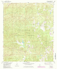
1979 Map of Pondville
USGS Topo · Published 1985About this map
The Pondville settlement sits at the center of a landscape heavily defined by timber and conservation, where the Oakmulgee Wildlife Management Area Boundary meets the Talladega National Forest. In this part of central Alabama, the terrain is carved by a dense network of waterways including Affonee Creek and Blue Girth Creek, while the Bibb Co and Perry Co line cuts across the southern portion of the sheet. The area's social history is recorded through numerous rural religious and burial sites, such as Union Grove Ch and the Mathis Cem near the eastern margin. A solitary Lookout Tower overlooking the creek valleys underscores the focus on forestry and fire management that shaped this region during the late twentieth century.
Find a feature on this map
20 named features on this map. Tap any name to fly to it.
Don’t see what you’re looking for? This feature index may not catch every label — zoom into the map to look around manually.
Map Details
Editions of this 1979 Pondville Map
2 editions found

Other maps of this area

1899 · Brookwood
USGS Topo · 1:125,000

1931 · Cottondale
USGS Topo · 1:48,000

1934 · Cottondale
USGS Topo · 1:62,500

1934 · Blocton
USGS Topo · 1:48,000

1940 · Blocton
USGS Topo · 1:62,500

1953 · Montgomery
USGS Topo · 1:250,000

1953 · Birmingham
USGS Topo · 1:250,000

1956 · Birmingham
USGS Topo · 1:250,000

1956 · Montgomery
USGS Topo · 1:250,000

1957 · Birmingham
USGS Topo · 1:250,000