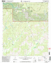
2002 Map of Hogglesville
USGS Topo · Published 2003About this map
The Talladega National Forest and Oakmulgee Wildlife Management Area dominate this section of the Alabama landscape, preserving a network of rural settlements and religious sites at the turn of the 21st century. Small communities like Hogglesville, Wateroak, and North Perry serve as anchors for the surrounding countryside, which is deeply marked by its spiritual and genealogical heritage. Numerous country churches and their associated burial grounds are scattered throughout, including Morgan Tabernacle, Antioch Ch, and Providence Ch. The topography is defined by the drainage systems of Brush Creek and Little Brush Creek, where the presence of a Gravel Pit suggests localized resource extraction amidst the protected timberlands. The convergence of the Bibb and Perry County lines and the Hale and Perry County boundaries highlights the map's position at a significant regional crossroad of administrative and natural geography.
Find a feature on this map
38 named features on this map. Tap any name to fly to it.
Don’t see what you’re looking for? This feature index may not catch every label — zoom into the map to look around manually.
Map Details
Editions of this 2002 Hogglesville Map
This is the sole edition of this map. No revisions or reprints were ever made.
Other maps of this area

1953 · Montgomery
USGS Topo · 1:250,000

1956 · Montgomery
USGS Topo · 1:250,000

1957 · Montgomery
USGS Topo · 1:250,000

1979 · Marion North
USGS Topo · 1:24,000

1979 · Morgan Springs
USGS Topo · 1:24,000

1979 · Greensboro
USGS Topo · 1:24,000

1979 · Pondville
USGS Topo · 1:24,000

1980 · Payne Lake
USGS Topo · 1:24,000

1980 · Ingram
USGS Topo · 1:24,000
1980 · Hogglesville
USGS Topo · 1:24,000