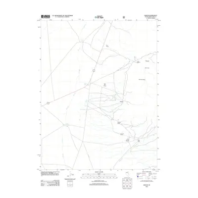
2012 Map of Hogum
USGS Topo · Published 2012About this map
Osceola and the settlement of Hogum anchor this 2012 study of the eastern White Pine County landscape. This high-altitude region is defined by a series of steep drainages cutting westward from the heights, including Mary Ann Canyon, Grub Gulch, and Serpent Gulch. The map records a transition between the elevated terrain of Pilot Knob Ridge and the lower alluvial reaches where water sources like Willard Springs and Layton Spring emerge. Traces of human activity are centered on the winding Osceola Rd and Co Rd 39, which connect the scattered settlements and the Willard Creek Ranch. The intricate network of seasonal watercourses, such as Spring Cr and Willard Cr, illustrates the complex drainage patterns vital to the ranching and mining history of this part of the Snake Range.
Find a feature on this map
18 named features on this map. Tap any name to fly to it.
Don’t see what you’re looking for? This feature index may not catch every label — zoom into the map to look around manually.
Map Details
Editions of this 2012 Hogum Map
This is the sole edition of this map. No revisions or reprints were ever made.
Other maps of this area

1948 · Wheeler Peak
USGS Topo · 1:62,500

1950 · Wheeler Peak
USGS Topo · 1:62,500

1952 · Ely
USGS Topo · 1:125,000

1956 · Lund
USGS Topo · 1:250,000

1956 · Ely
USGS Topo · 1:250,000

1959 · Ely
USGS Topo · 1:250,000

1959 · Sacramento Pass
USGS Topo · 1:62,500

1959 · Connors Pass
USGS Topo · 1:62,500

1960 · Lund
USGS Topo · 1:250,000

1963 · Ely
USGS Topo · 1:250,000