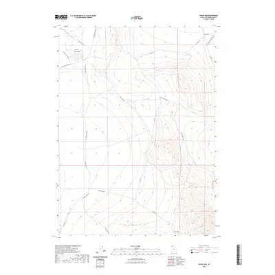
2023 Map of Hogup Bar
USGS Topo · Published 2023About this map
Sinks of Dove Creek mark a distinctive hydrological point in this arid landscape, where the waters of Dove Creek vanish into the basin floor. This 2023 survey of the Hogup Mountains region of Box Elder County illustrates a remote network of ranch and access roads that follow the contours of the desert terrain. The presence of Old Railroad Grade Rd highlights the corridor of the First Transcontinental Railroad's original route, a critical piece of nineteenth-century infrastructure that once bypassed the Great Salt Lake to the north. Travel through this area is defined by strategic crossings like Big Pass and the winding Board Ranch Rd. Local history is embedded in the nomenclature of the landscape, from the utilitarian Government Well Rd to the secluded Hogup Cabin Rd and the prominent Crocodile Mountain Rd.
Find a feature on this map
18 named features on this map. Tap any name to fly to it.
Don’t see what you’re looking for? This feature index may not catch every label — zoom into the map to look around manually.
Map Details
Editions of this 2023 Hogup Bar Map
This is the sole edition of this map. No revisions or reprints were ever made.
Other maps of this area

1954 · Brigham City
USGS Topo · 1:250,000

1958 · Brigham City
USGS Topo · 1:250,000

1962 · Brigham City
USGS Topo · 1:250,000

1969 · Peplin Flats
USGS Topo · 1:24,000

1969 · Dolphin Island West
USGS Topo · 1:24,000

1969 · Crocodile Mtn NE
USGS Topo · 1:24,000

1969 · Hogup Bar
USGS Topo · 1:24,000
1969 · Crocodile Mtn SE
USGS Topo · 1:24,000

1971 · Matlin
USGS Topo · 1:24,000
1971 · Russian Knoll
USGS Topo · 1:24,000