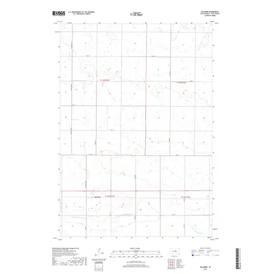
2017 Map of Holabird
USGS Topo · Published 2017About this map
Holabird stands as the primary settlement in this Hyde County landscape, situated along the established path of Highway 14 and the Holabird Grade. The surrounding terrain is defined by the winding course of the S Fork Medicine Knoll Cr to the south, which cuts through a grid of section lines and rural routes. This 2017 survey illustrates a modern township structure, where agriculture and open land are partitioned by a network of local roads including 328th Ave and 330th Ave. The map provides a clear look at the intersection of rural transit and natural hydrology, with small wetlands and depressions scattered across the northern sections near Co Rd 648. For researchers, the map serves as a precise guide to the contemporary layout of this South Dakota prairie region, preserving the exact placement of local infrastructure and namesake geographic features.
Find a feature on this map
18 named features on this map. Tap any name to fly to it.
Don’t see what you’re looking for? This feature index may not catch every label — zoom into the map to look around manually.
Map Details
Editions of this 2017 Holabird Map
This is the sole edition of this map. No revisions or reprints were ever made.
Other maps of this area

1949 · Mitchell Lake
USGS Topo · 1:24,000

1950 · Mitchell Lake
USGS Topo · 1:24,000

1950 · Highmore
USGS Topo · 1:24,000

1953 · Huron
USGS Topo · 1:250,000

1954 · Huron
USGS Topo · 1:250,000

1968 · Harrold NW
USGS Topo · 1:24,000

1968 · Harrold
USGS Topo · 1:24,000

1968 · Holabird
USGS Topo · 1:24,000

1968 · Harrold NE
USGS Topo · 1:24,000

1973 · Chapelle Lake
USGS Topo · 1:24,000