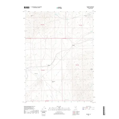
2018 Map of Holborn
USGS Topo · Published 2018About this map
Independence Valley provides a central corridor through this section of Elko County, flanked by the prominent Windermere Hills to the northwest and the Pequop Mountains to the southeast. The small settlements of Holborn and Fenelon are positioned along the primary transit route that bisects the valley floor, reflecting the traditional pattern of isolated Great Basin outposts linked by rail and road.
Find a feature on this map
22 named features on this map. Tap any name to fly to it.
Don’t see what you’re looking for? This feature index may not catch every label — zoom into the map to look around manually.
Map Details
Editions of this 2018 Holborn Map
This is the sole edition of this map. No revisions or reprints were ever made.
Other maps of this area

1955 · Wells
USGS Topo · 1:250,000

1958 · Wells
USGS Topo · 1:250,000

1961 · Wells
USGS Topo · 1:250,000

1968 · Moor Summit
USGS Topo · 1:24,000

1968 · Holborn
USGS Topo · 1:24,000

1968 · Melandco
USGS Topo · 1:24,000

1968 · Pequop
USGS Topo · 1:24,000
1968 · Pequop Summit SW
USGS Topo · 1:24,000

1968 · Wells Peak
USGS Topo · 1:24,000
1968 · Pequop Summit
USGS Topo · 1:24,000