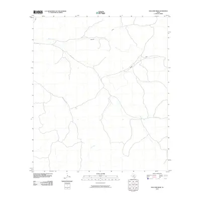
2010 Map of Holcomb Draw
USGS Topo · Published 2010About this map
Holcomb serves as a central point of reference in this West Texas landscape, where the drainage patterns of the Edwards Plateau dictate the movement of both water and travelers. The topography is defined by significant landmarks such as Bolden and a prominent Draw that carves through the limestone terrain. Transportation in this part of Val Verde County is characterized by utilitarian paths like Mail Trail Rd and Vinegeroon Draw Rd, which follow the natural contours of the land to connect disparate points in the brush country. Water features are sparse but vital, represented here by the intermittent flows of Mailtrail Creek in the north and Cow Creek to the south. This survey captures a moment in the early 21st century before modern expansion significantly altered these traditional ranching routes and desert drainages.
Find a feature on this map
7 named features on this map. Tap any name to fly to it.
Don’t see what you’re looking for? This feature index may not catch every label — zoom into the map to look around manually.
Map Details
Editions of this 2010 Holcomb Draw Map
This is the sole edition of this map. No revisions or reprints were ever made.
Other maps of this area

1943 · Carta Valley
USGS Topo · 1:62,500

1944 · Dry Devil
USGS Topo · 1:62,500

1954 · Sonora
USGS Topo · 1:250,000

1958 · Sonora
USGS Topo · 1:250,000

1958 · Del Rio
USGS Topo · 1:250,000

1964 · Del Rio
USGS Topo · 1:250,000

1971 · Turney Draw SE
USGS Topo · 1:24,000
1971 · Carta Valley NE
USGS Topo · 1:24,000

1973 · Robinson Draw
USGS Topo · 1:24,000

1973 · Four Mills
USGS Topo · 1:24,000