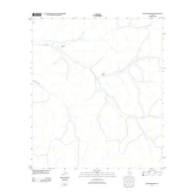
2012 Map of Holcomb Draw
USGS Topo · Published 2012About this map
Mailtrail Cr winds across this arid stretch of Val Verde County, defining a landscape shaped by intermittent drainage and the pastoral needs of West Texas ranching. The terrain is marked by significant topographical depressions such as Holcomb Draw and Bolden Draw, which serve as natural conduits for seasonal runoff toward Cow Cr. Transportation in this area is sparse, primarily consisting of unpaved routes like Mail Trail Rd and Vinegerroon Draw Rd that follow the natural contours of the land. This 2012 survey illustrates the enduring rural character of the region, where land use remains centered on large-scale grazing and the traditional management of water resources in a challenging environment.
Find a feature on this map
6 named features on this map. Tap any name to fly to it.
Don’t see what you’re looking for? This feature index may not catch every label — zoom into the map to look around manually.
Map Details
Editions of this 2012 Holcomb Draw Map
This is the sole edition of this map. No revisions or reprints were ever made.
Other maps of this area

1943 · Carta Valley
USGS Topo · 1:62,500

1944 · Dry Devil
USGS Topo · 1:62,500

1954 · Sonora
USGS Topo · 1:250,000

1958 · Sonora
USGS Topo · 1:250,000

1958 · Del Rio
USGS Topo · 1:250,000

1964 · Del Rio
USGS Topo · 1:250,000

1971 · Turney Draw SE
USGS Topo · 1:24,000
1971 · Carta Valley NE
USGS Topo · 1:24,000

1973 · Robinson Draw
USGS Topo · 1:24,000

1973 · Four Mills
USGS Topo · 1:24,000