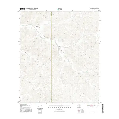
2016 Map of Holcomb Draw
USGS Topo · Published 2016About this map
Mailtrail Creek snakes through this high-desert landscape on the border of Val Verde and Edwards counties, carving a path through the distinct limestone drainage patterns characteristic of the Edwards Plateau. This 2016 survey documents a sparsely populated ranching region defined by its hydrographic network, where deep seasonal channels like Holcomb Draw and Vinegarone Draw converge toward the Pecos River basin. The map reveals the infrastructure of remote West Texas ranching, centered on the Bar C Ranch Airport and a limited network of unpaved access routes including Mail Trail Rd and Vinegeroon Draw Rd. This terrain illustrates the vital importance of intermittent water sources and the geographic isolation of the frontier, where named landmarks are often restricted to the significant draws and creeks that dictate the movement of people and livestock.
Find a feature on this map
12 named features on this map. Tap any name to fly to it.
Don’t see what you’re looking for? This feature index may not catch every label — zoom into the map to look around manually.
Map Details
Editions of this 2016 Holcomb Draw Map
This is the sole edition of this map. No revisions or reprints were ever made.
Other maps of this area

1943 · Carta Valley
USGS Topo · 1:62,500

1944 · Dry Devil
USGS Topo · 1:62,500

1954 · Sonora
USGS Topo · 1:250,000

1958 · Sonora
USGS Topo · 1:250,000

1958 · Del Rio
USGS Topo · 1:250,000

1964 · Del Rio
USGS Topo · 1:250,000

1971 · Turney Draw SE
USGS Topo · 1:24,000
1971 · Carta Valley NE
USGS Topo · 1:24,000

1973 · Robinson Draw
USGS Topo · 1:24,000

1973 · Four Mills
USGS Topo · 1:24,000