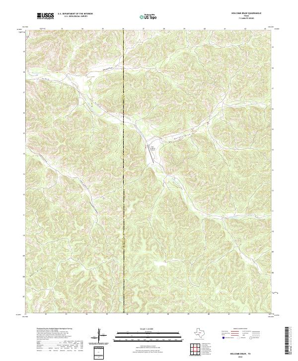
2022 Map of Holcomb Draw
USGS Topo · Published 2022About this map
Holcomb Draw and the surrounding plateau of the western Edwards Plateau define a landscape carved by seasonal drainage and a network of remote ranch roads. This area sits along the boundary of Val Verde and Edwards counties, where water management and transportation follow the winding course of Mailtrail Creek. The presence of the Bar C Ranch Airport indicates the reliance on private aviation for connecting these isolated ranching operations to larger Texas hubs. Grounded in the local topography, the map traces deep cuts like Bolden Draw and Vinegarone Draw, which channel runoff toward the creek during infrequent but heavy rains. Historically, routes like Mail Trail Rd and Vinegaroon Draw Rd served as essential lifelines through this sparsely populated territory, linking scattered ranching outposts across the high plains of Southwest Texas.
Find a feature on this map
11 named features on this map. Tap any name to fly to it.
Don’t see what you’re looking for? This feature index may not catch every label — zoom into the map to look around manually.
Map Details
Editions of this 2022 Holcomb Draw Map
This is the sole edition of this map. No revisions or reprints were ever made.
Other maps of this area

1943 · Carta Valley
USGS Topo · 1:62,500

1944 · Dry Devil
USGS Topo · 1:62,500

1954 · Sonora
USGS Topo · 1:250,000

1958 · Sonora
USGS Topo · 1:250,000

1958 · Del Rio
USGS Topo · 1:250,000

1964 · Del Rio
USGS Topo · 1:250,000

1971 · Turney Draw SE
USGS Topo · 1:24,000
1971 · Carta Valley NE
USGS Topo · 1:24,000

1973 · Robinson Draw
USGS Topo · 1:24,000

1973 · Four Mills
USGS Topo · 1:24,000