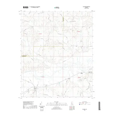
2018 Map of Holcomb
USGS Topo · Published 2018About this map
Holcomb serves as the primary settlement on this landscape, situated near the intersection of several local routes such as S Main St W and Paschal St. The surrounding terrain is defined by the winding course of the Yalobusha River and its numerous tributaries, including Long Creek and McSwine Cr. This area of Grenada County is notable for its high density of family and community burial grounds, such as Tuscohoma Cem, Trimbell Cem, and Cole Cem, providing significant points of interest for genealogical research. The map also highlights the rural infrastructure of the era, from the landing strip at Spencer Field near the eastern margin to the small community of Bew Springs. The landscape is a network of ridges and creek bottoms, with labels like Turkey Foot Folk and Pea Ridge Cem reflecting the local topography and naming conventions of this North Mississippi region.
Find a feature on this map
65 named features on this map. Tap any name to fly to it.
Don’t see what you’re looking for? This feature index may not catch every label — zoom into the map to look around manually.
Map Details
Editions of this 2018 Holcomb Map
This is the sole edition of this map. No revisions or reprints were ever made.
Other maps of this area

1932 · Philipp
USGS Topo · 1:48,000

1935 · Philipp
USGS Topo · 1:62,500

1936 · Greenwood
USGS Topo · 1:62,500

1939 · Philipp
USGS Topo · 1:62,500

1940 · Greenwood
USGS Topo · 1:62,500

1953 · Greenwood
USGS Topo · 1:250,000

1953 · West Point
USGS Topo · 1:250,000

1954 · Grenada
USGS Topo · 1:62,500

1954 · McCarley
USGS Topo · 1:62,500

1956 · Greenwood
USGS Topo · 1:250,000