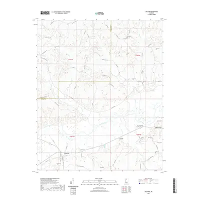
2020 Map of Holcomb
USGS Topo · Published 2020About this map
Holcomb serves as the primary hub in this corner of the Mississippi Delta, where the grid of Paschal St and Main St meets the rural expanse of Grenada and Tallahatchie counties. The Yalobusha River winds through the central landscape, accompanied by a dense network of tributaries including McSwine Cr, Long Creek, and Turnbull Cr. This riverine environment is punctuated by small, scattered settlements like Dubard and Bew Springs, which are connected by a web of named country roads such as Cascilla Rd and Pea Ridge Rd. Genealogy researchers will find significant value in the numerous family-named landmarks and burial grounds, such as Tascohomo Cem, Ashland Cem, Trimbell Cem, and Harris Cem, which are often located near historic farmsteads or old crossroads.
Find a feature on this map
64 named features on this map. Tap any name to fly to it.
Don’t see what you’re looking for? This feature index may not catch every label — zoom into the map to look around manually.
Map Details
Editions of this 2020 Holcomb Map
This is the sole edition of this map. No revisions or reprints were ever made.
Other maps of this area

1932 · Philipp
USGS Topo · 1:48,000

1935 · Philipp
USGS Topo · 1:62,500

1936 · Greenwood
USGS Topo · 1:62,500

1939 · Philipp
USGS Topo · 1:62,500

1940 · Greenwood
USGS Topo · 1:62,500

1953 · Greenwood
USGS Topo · 1:250,000

1953 · West Point
USGS Topo · 1:250,000

1954 · Grenada
USGS Topo · 1:62,500

1954 · McCarley
USGS Topo · 1:62,500

1956 · Greenwood
USGS Topo · 1:250,000