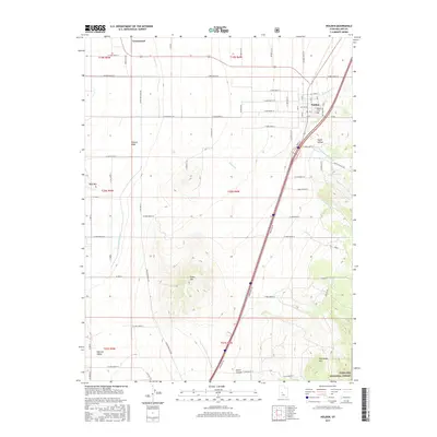
2017 Map of Holden
USGS Topo · Published 2017About this map
Holden and the agricultural lands of the Pahvant Valley are meticulously documented in this 2017 survey of Millard County. The map details the precise irrigation network essential to this arid landscape, featuring the Central Utah Canal alongside numerous ditches such as the Current Spring Ditch and Johnson Ditch. This reliance on managed water stands in sharp contrast to the natural drainages of Pioneer Cr and Wild Goose Cr that flow from the eastern highlands.
Find a feature on this map
75 named features on this map. Tap any name to fly to it.
Don’t see what you’re looking for? This feature index may not catch every label — zoom into the map to look around manually.
Map Details
Editions of this 2017 Holden Map
This is the sole edition of this map. No revisions or reprints were ever made.
Other maps of this area

1885 · Beaver
USGS Topo · 1:250,000

1885 · Sevier Desert
USGS Topo · 1:250,000

1953 · Richfield
USGS Topo · 1:250,000

1953 · Delta
USGS Topo · 1:250,000

1958 · Richfield
USGS Topo · 1:250,000

1958 · Delta
USGS Topo · 1:250,000

1960 · Meadow
USGS Topo · 1:24,000

1961 · Fillmore
USGS Topo · 1:24,000

1961 · Mt. Catherine
USGS Topo · 1:24,000

1961 · Richfield
USGS Topo · 1:62,500