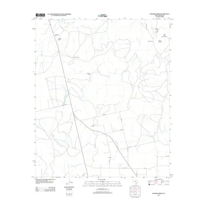
2012 Map of Holder Creek
USGS Topo · Published 2012About this map
The Divide serves as a central topographical feature in this section of Nolan County, where the landscape is defined by the headwaters of numerous seasonal drainages. The complex network of draws and creeks, including Hoodoo Draw, Robtann Draw, and Dill Canyon, illustrates the erosional patterns of the West Texas plains. Water sources are critical in this arid environment, marked by the presence of Barrel Spring, Boothe Lake, and Nolan Divide Lake, which likely support the ranching operations characteristic of the region.
Find a feature on this map
32 named features on this map. Tap any name to fly to it.
Don’t see what you’re looking for? This feature index may not catch every label — zoom into the map to look around manually.
Map Details
Editions of this 2012 Holder Creek Map
This is the sole edition of this map. No revisions or reprints were ever made.
Other maps of this area

1893 · Sweetwater
USGS Topo · 1:125,000

1954 · Big Spring
USGS Topo · 1:250,000

1957 · Merkel
USGS Topo · 1:62,500

1958 · Big Spring
USGS Topo · 1:250,000

1967 · Hylton
USGS Topo · 1:24,000

1969 · Blackwell NE
USGS Topo · 1:24,000

1969 · Maryneal
USGS Topo · 1:24,000

1969 · Sweetwater
USGS Topo · 1:24,000

1969 · Holder Creek
USGS Topo · 1:24,000
1969 · Lake Sweetwater
USGS Topo · 1:24,000