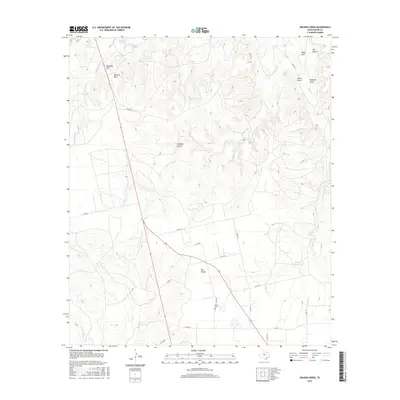
2016 Map of Holder Creek
USGS Topo · Published 2016About this map
The Divide forms a central geographic spine through this portion of Nolan County, where the high tablelands of the Edwards Plateau begin their descent toward the Texas plains. The landscape is defined by its drainage patterns, with Holder Creek and its many offshoots, such as Hoodoo Draw and Robtann Draw, cutting through the terrain. To the north, prominent elevations like Wildcat Mtn and Ninemile Hill rise above the surrounding country, while the northeast corner is marked by the distinct Merry Point overlooking Dill Canyon. Local history is anchored at the Nolan Cem, a significant marker of settlement in this rural landscape. The area's water sources, including Barrel Spring and Boothe Lake, provide vital points of interest for researchers studying the historical development and livestock ranching patterns of this region before the more modern expansion of local road networks.
Find a feature on this map
32 named features on this map. Tap any name to fly to it.
Don’t see what you’re looking for? This feature index may not catch every label — zoom into the map to look around manually.
Map Details
Editions of this 2016 Holder Creek Map
This is the sole edition of this map. No revisions or reprints were ever made.
Other maps of this area

1893 · Sweetwater
USGS Topo · 1:125,000

1954 · Big Spring
USGS Topo · 1:250,000

1957 · Merkel
USGS Topo · 1:62,500

1958 · Big Spring
USGS Topo · 1:250,000

1967 · Hylton
USGS Topo · 1:24,000

1969 · Blackwell NE
USGS Topo · 1:24,000

1969 · Maryneal
USGS Topo · 1:24,000

1969 · Sweetwater
USGS Topo · 1:24,000

1969 · Holder Creek
USGS Topo · 1:24,000
1969 · Lake Sweetwater
USGS Topo · 1:24,000