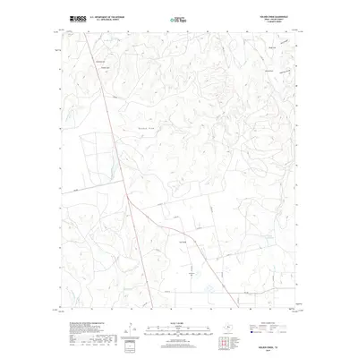
2019 Map of Holder Creek
USGS Topo · Published 2019About this map
Nolan Cem serves as a small but significant historical marker in this portion of Nolan County, where the high plains of the Llano Estacado meet the rolling breaks of North Central Texas. The landscape is defined by the prominent ridge known as The Divide, which separates the drainage systems of the region. Water sources in this arid environment are critical, highlighted by features like Barrel Spring, Boothe Lake, and the ephemeral Nolan Divide Lake.
Find a feature on this map
32 named features on this map. Tap any name to fly to it.
Don’t see what you’re looking for? This feature index may not catch every label — zoom into the map to look around manually.
Map Details
Editions of this 2019 Holder Creek Map
This is the sole edition of this map. No revisions or reprints were ever made.
Other maps of this area

1893 · Sweetwater
USGS Topo · 1:125,000

1954 · Big Spring
USGS Topo · 1:250,000

1957 · Merkel
USGS Topo · 1:62,500

1958 · Big Spring
USGS Topo · 1:250,000

1967 · Hylton
USGS Topo · 1:24,000

1969 · Blackwell NE
USGS Topo · 1:24,000

1969 · Maryneal
USGS Topo · 1:24,000

1969 · Sweetwater
USGS Topo · 1:24,000

1969 · Holder Creek
USGS Topo · 1:24,000
1969 · Lake Sweetwater
USGS Topo · 1:24,000