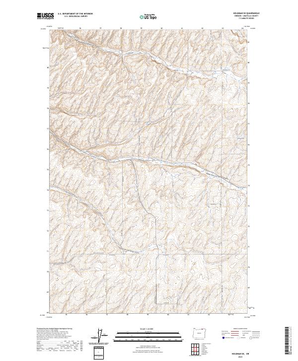
2023 Map of Holdman SE
USGS Topo · Published 2023About this map
The rolling agricultural and canyon country of Umatilla County is defined here by the convergence of the Cold Springs drainage system. This landscape is deeply carved by North Fork Cold Springs Canyon, Middle Fork Cold Springs Canyon, and South Fork Cold Springs Canyon, which dictate the local topography and the winding paths of the rural road network.
Find a feature on this map
26 named features on this map. Tap any name to fly to it.
Don’t see what you’re looking for? This feature index may not catch every label — zoom into the map to look around manually.
Map Details
Editions of this 2023 Holdman SE Map
This is the sole edition of this map. No revisions or reprints were ever made.
Other maps of this area

1935 · Pendleton
USGS Topo · 1:125,000

1953 · Pendleton
USGS Topo · 1:250,000

1956 · Pendleton
USGS Topo · 1:250,000
1966 · Juniper Canyon
USGS Topo · 1:24,000

1966 · Holdman
USGS Topo · 1:24,000
1966 · Smeltz
USGS Topo · 1:24,000

1966 · Holdman SE
USGS Topo · 1:24,000

1966 · Pendleton
USGS Topo · 1:24,000

1966 · Mission
USGS Topo · 1:24,000
1966 · Ring
USGS Topo · 1:24,000