Loading...
Loading map...1896 Map of Holdrege
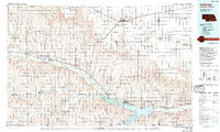
USGS Topo · Published 1937About this map
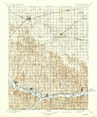
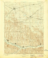
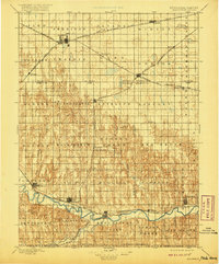
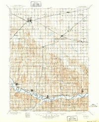
The Republican River carves a deep valley across the southern portion of this landscape, creating a distinct topographical contrast with the high plains to the north. Settlement in the late nineteenth century followed the path of the water and the steel, with river towns like Alma, Orleans, and Republican City anchoring the valley's economy. In the northern uplands, the rail network dictated the growth of agricultural hubs, most notably Holdrege, which sits at a significant junction of the B. & Mo. Riv. R. R. (Main Line).
Find a feature on this map
68 named features on this map. Tap any name to fly to it.
Don’t see what you’re looking for? This feature index may not catch every label — zoom into the map to look around manually.
Map Details
Date Portrayed1896
Date Published1937
PublisherU.S. Geological Survey
Map TypeTopographic
Scale1:125,000
Physical Dimensions16.5 x 19.8 inches
Editions of this 1896 Holdrege Map
5 editions found

Historical Maps of Holdrege Through Time
Featured Locations
Source Details
SourceU.S. Geological Survey
CopyrightPublic Domain