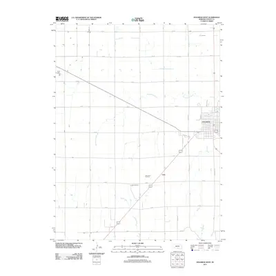
2011 Map of Holdrege West
USGS Topo · Published 2011About this map
Holdrege and its western outskirts anchor this Phelps County landscape, revealing a highly organized agricultural and residential pattern established by the early 21st century. The map illustrates the town's expansion toward Chrisoma Villa, contrasting the dense street grid of the city center with the surrounding rural townships. This survey captures the vital relationship between Nebraska's irrigation-dependent farming and the natural drainage provided by Sacramento Creek and Turkey Creek. Significant rural landmarks like Linder Stock Farms and the McClymont Feed Yard highlight the livestock industry's footprint on the plains. For local historians, the placement of the Industry Cemetery and the small settlement of Clyde along the highway corridor provides essential geographic markers of the area's development outside the primary municipal center.
Find a feature on this map
21 named features on this map. Tap any name to fly to it.
Don’t see what you’re looking for? This feature index may not catch every label — zoom into the map to look around manually.
Map Details
Editions of this 2011 Holdrege West Map
This is the sole edition of this map. No revisions or reprints were ever made.
Other maps of this area

1896 · Lexington
USGS Topo · 1:125,000

1896 · Holdrege
USGS Topo · 1:125,000

1896 · Kearney
USGS Topo · 1:125,000

1896 · Arapahoe
USGS Topo · 1:125,000

1898 · Arapahoe
USGS Topo · 1:125,000

1899 · Lexington
USGS Topo · 1:125,000

1955 · Grand Island
USGS Topo · 1:250,000

1957 · Grand Island
USGS Topo · 1:250,000

1958 · Grand Island
USGS Topo · 1:250,000

1958 · Mascot
USGS Topo · 1:24,000