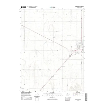
2014 Map of Holdrege West
USGS Topo · Published 2014About this map
The western edge of Holdrege anchors this survey of Phelps County, Nebraska, showing the town's expansion along the intersection of Us-183 and Us-34. The landscape is defined by the gridded precision of section-line roads, such as 731 Rd and 730 Rd, which cut across the subtle drainage of Sacramento Cr and Turkey Cr. These watercourses provided the natural logic for the early agricultural layout before the dominance of the highway system.
Find a feature on this map
45 named features on this map. Tap any name to fly to it.
Don’t see what you’re looking for? This feature index may not catch every label — zoom into the map to look around manually.
Map Details
Editions of this 2014 Holdrege West Map
This is the sole edition of this map. No revisions or reprints were ever made.
Other maps of this area

1896 · Lexington
USGS Topo · 1:125,000

1896 · Holdrege
USGS Topo · 1:125,000

1896 · Kearney
USGS Topo · 1:125,000

1896 · Arapahoe
USGS Topo · 1:125,000

1898 · Arapahoe
USGS Topo · 1:125,000

1899 · Lexington
USGS Topo · 1:125,000

1955 · Grand Island
USGS Topo · 1:250,000

1957 · Grand Island
USGS Topo · 1:250,000

1958 · Grand Island
USGS Topo · 1:250,000

1958 · Mascot
USGS Topo · 1:24,000