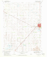
1970 Map of Holdrege West
USGS Topo · Published 1972About this map
Holdrege serves as the primary urban center of this Phelps County landscape, showing its mid-century expansion along the Burlington Northern railroad. The map documents the city's civic infrastructure during this era, including the Washington Sch, Jr High Sch, and the local Hospital. Beyond the town limits, the terrain transitions into the agricultural expanse of Laird and Sheridan townships, where the Industry Cem and the settlement of Clyde mark the rural social geography.
Find a feature on this map
23 named features on this map. Tap any name to fly to it.
Don’t see what you’re looking for? This feature index may not catch every label — zoom into the map to look around manually.
Map Details
Editions of this 1970 Holdrege West Map
This is the sole edition of this map. No revisions or reprints were ever made.
Other maps of this area

1896 · Lexington
USGS Topo · 1:125,000

1896 · Holdrege
USGS Topo · 1:125,000

1896 · Kearney
USGS Topo · 1:125,000

1896 · Arapahoe
USGS Topo · 1:125,000

1898 · Arapahoe
USGS Topo · 1:125,000

1899 · Lexington
USGS Topo · 1:125,000

1955 · Grand Island
USGS Topo · 1:250,000

1957 · Grand Island
USGS Topo · 1:250,000

1958 · Grand Island
USGS Topo · 1:250,000

1958 · Mascot
USGS Topo · 1:24,000