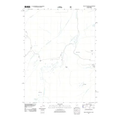
2011 Map of Hole In The Rock
USGS Topo · Published 2011About this map
West Fork Beaver Creek, Middle Fork Beaver Creek, and East Fork Beaver Creek define the hydrology of this high-elevation landscape along the border of Utah and Wyoming. The terrain is characterized by broad meadows and glacial features, notably the open spaces of Willow Park, Georges Park, and Beaver Parks. These drainages converge as they flow northward, flanked by the prominent heights of Coal Mine Hill and the long expanse of Burnt Ridge.
Find a feature on this map
18 named features on this map. Tap any name to fly to it.
Don’t see what you’re looking for? This feature index may not catch every label — zoom into the map to look around manually.
Map Details
Editions of this 2011 Hole In The Rock Map
This is the sole edition of this map. No revisions or reprints were ever made.
Other maps of this area

1885 · Uinta
USGS Topo · 1:250,000

1905 · Gilbert Peak
USGS Topo · 1:125,000

1906 · Gilbert Peak
USGS Topo · 1:125,000

1954 · Salt Lake City
USGS Topo · 1:250,000

1954 · Ogden
USGS Topo · 1:250,000

1958 · Ogden
USGS Topo · 1:250,000

1958 · Salt Lake City
USGS Topo · 1:250,000

1960 · Ogden
USGS Topo · 1:250,000

1960 · Salt Lake City
USGS Topo · 1:250,000
1964 · Lonetree
USGS Topo · 1:24,000